If you think it’s cold now, it’s going to get even colder over the next few days!
A series of active fronts embedded in a cold southwest flow move over New Zealand from tomorrow bringing periods of strong winds and rain to many places. It’s looking like it will get especially cold over the country on Sunday and Monday, and this is when snow could fall to sea level in Southland and Clutha.
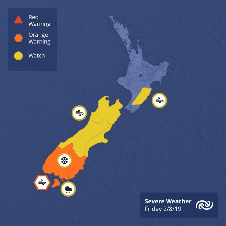
The theme for the next five or six days is cold, windy and unsettled. Warnings and Watches are in force for many areas on Friday (shown below), and more warnings are possible this weekend.

Severe gales for central and southern parts of the country. Heavy rain and snow for southern New Zealand.
An active cold front is forecast to move quickly eastwards across New Zealand on Friday bringing a change to strong southwesterlies, while an associated deep low also moves eastwards past the south of the South Island.
Strong Wind Warning – Orange
Strong wind gusts could damage trees, powerlines and unsecured structures. Driving may be hazardous, especially for high-sided vehicles and motorcycles.
Area: Fiordland, Southland and the Southern Lakes
Valid: 14 hours from 5:00am to 7:00pm Friday
Forecast: Severe gale west to southwesterlies, gusting 120 km/h in exposed places.

