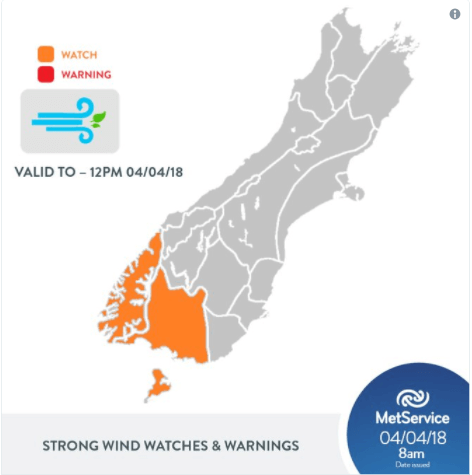
Westerly gales over the far south of the South Island, easing this afternoon.
A westerly flow covers the South Island over the next few days with a series of weak embedded fronts. Gale westerlies about the far south this morning (Wednesday), could possibly reach severe gale for a time in localised areas, then ease in the afternoon.
People are advised to keep up to date with the latest forecasts in case any areas in this Watch are upgraded to a full Warning.
Strong Wind Watch
Area: Fiordland and Southland, including Stewart Island
Valid: 4 hours from 8:00am to 12:00pm Wednesday
Forecast: West to northwest winds, gale in exposed places, may briefly reach severe gale this morning, especially about the Fiordland Lakes and Stewart Island. Westerlies easing this afternoon.
This watch will be updated by: 9:00pm Wednesday 04-Apr-2018
A westerly flow covers the South Island the next few days with a series of weak embedded fronts. Gale westerlies about the far south this morning (Wednesday), could possibly reach severe gale for a time in localised areas, then ease this afternoon. https://t.co/qHyE5zhh6X ^KL pic.twitter.com/MkZFfQMY3V
— MetService (@MetService) April 3, 2018

